Revealing the Secrets: How to Read GPS Coordinates Like a Pro
Are you lost in a huge city or just want to pinpoint your location to your friends?
Contents:
Are you lost in a huge city or just want to pinpoint your location to your friends?
GPS coordinates are your key to absolute accuracy!
In the era of smartphones and navigators, everyone has become accustomed to GPS reading. Especially not to track a cell phone by number - the Number Tracker app.
However, understanding GPS coordinates seems difficult to everyone!
Anyway, let's take a closer look at these degrees, minutes, and seconds so that you can not only read GPS coordinates like a professional, but also use them. Well, how to read GPS location?
General Information
So, you're holding your phone (or navigator) in your hands, and it magically shows your location on the map. How often do you wonder at such moments how reading GPS coordinates works?
Right now, there are many satellites flying over our heads. You can't see them, but they're constantly transmitting signals.
GPS (Global Positioning System) is the very set of high-tech satellites designed to ensure that you never get lost again!
This is an entire system developed and maintained by the United States that provides location information anywhere on the planet around the clock. Read about its inventors.
It's a huge network in the sky that helps us find each other and useful places. And all this so that you can eventually learn how to read GPS coordinates.
Principles of GPS Operation
How do these satellites determine where you are? GPS coordinates how to read?
Stage 1 | Your GPS receiver (phone, navigator) picks up signals from at least four satellites. |
Stage 2 |
|
Stage 3 | The fourth satellite is needed to clarify the time and eliminate errors. |
And all this math happens in a split second!
Now you understand how to read GPS coordinates - this is the final result of complex calculations based on signals from space!

The Importance of GPS Coordinate Accuracy
Accuracy is what makes GPS so indispensable. But why do we need this precision? So that you can find your friend in the next street! Or so that rescuers can find you quickly if you're in a difficult situation (in this case GPS reading for short is essential).
Accurate GPS devices or other GPS systems (for example, Google Maps) are vital for:
navigation,
cartography,
geodesy,
emergency rescue,
and a bunch of other things.
The more accurate the data, the better we navigate the world and the more tasks we can solve using GPS. Therefore, understanding how to read GPS coordinates correctly is not just a desire, but a vital skill.
Now it's time to figure out what those numbers are that he's giving out.
It's about latitude and longitude. Without them, finding out how to read GPS coordinates is simply pointless!
Determination of Latitude and Longitude
Imagine a globe. Latitude and longitude are like a grid plotted on this globe to pinpoint any point.
Latitude
These are horizontal lines running parallel to the equator.
The equator is 0 degrees latitude. | |
The further north or south you are from the equator, the greater the latitude value. | |
The North pole | The South pole |
90 degrees north latitude | 90 degrees south latitude |
Latitude indicates how close you are to the equator or to the poles. Without understanding latitude, reading GPS coordinates is like looking for a needle in a haystack.
Longitude
These are vertical lines running from the North Pole to the South Pole.
The Greenwich meridian passing through the Greenwich Observatory in London is assumed to be the zero longitude.
Longitude indicates how far you are east or west of the Greenwich England Meridian.
Longitude values range from 0 to 180 degrees east and from 0 to 180 degrees west.
How They are Measured
Latitude and longitude are divided into degrees (°), minutes ('), and seconds (").
Degrees | These are the largest units of measurement. | One degree is 1/360 of a circle |
Minutes | Each degree is divided into 60 minutes. | That is, 1° = 60' |
Seconds | Each minute is divided into 60 seconds. | That is, 1' = 60" |
Therefore, when you see the coordinates, for example, 55°45'20"N 37°36'56"E, it means:
55 degrees, 45 minutes and 20 seconds north latitude
37 degrees, 36 minutes and 56 seconds east longitude
Graphical representation on the map
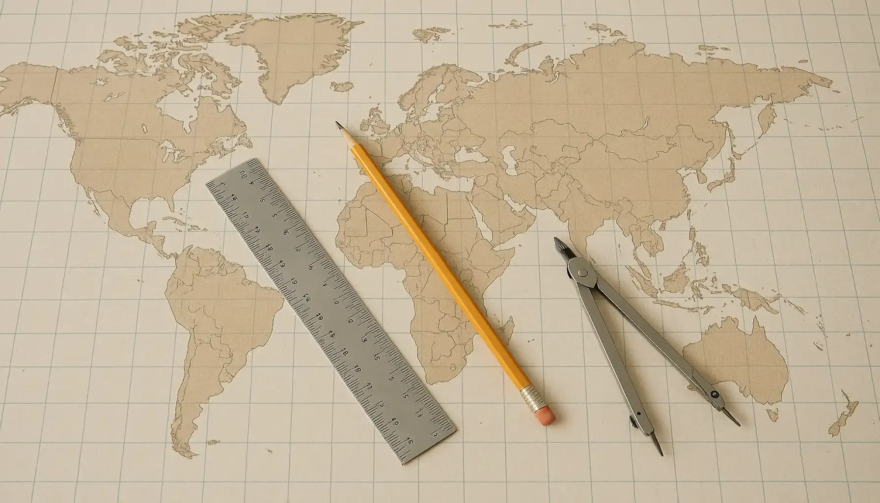
Look at the world map.
Lines of latitude are horizontal lines, and longitude lines are vertical lines.
The point of intersection of the latitude line and the longitude line is a unique place on Earth that can be accurately determined using coordinates.
On most maps, these lines are plotted to help you navigate.
Understanding how latitude and longitude are represented on a map allows you to visualize where you are and plan your routes.
Now that you know the basic terms of how to read GPS, the coordinates become much clearer.
How to Read GPS Coordinates?
So, now you know the details about latitude and longitude. But you also need to be able to read the map, that is, correctly read the GPS coordinates!
Coordinate recording format (decimal and degree formats)
Two geo-navigation languages.
GPS coordinates can be presented in two basic formats. It's like two different languages, but both speak about the same thing: where you are.
Decimal Degrees (DD) | This is the easiest format to understand. In it, latitude and longitude are expressed as decimal numbers. | For example: 40.7128° N, -74.0060° W. | The advantage of this format is simplicity, the disadvantage is the complexity of manual calculation. |
Degrees, Minutes and Seconds (DMS) | This is a more traditional format where latitude and longitude are expressed in degrees, minutes, and seconds. | For example: 40°42'46.1"N 74°00'21.7"W. | This format is more accurate, but also more difficult to perceive at first glance.To understand this format, you need to know how to read GPS coordinates in degrees minutes seconds. |

How to Interpret the Received Values
So you got the coordinates. Now how do you figure out where they lead?
Decimal Degrees
The number before the decimal point indicates the number of degrees, and the number after the point indicates the fraction of a degree. The more digits after the dot, the higher the accuracy.
Degrees, Minutes, and Seconds
Degrees first, then minutes, then seconds. It takes practice to learn how to navigate this format quickly.
Important details
The most important thing is not to forget about specifying the cardinal directions:
N | S | E | W |
North | South | East | West |
Latitude is always indicated with "N" or "S". "N" is the northern hemisphere, "S" is the southern hemisphere.
Longitude is always indicated with "E" or "W". "E" is the eastern hemisphere, "W" is the western hemisphere.
Always pay attention to the "N/S" and "E/W" when reading the GPS coordinates. It is important!
Now you know all the basic formats and subtleties of how to read GPS coordinates! And if you want to find out where your loved one is now, download the Number Tracker app.
How to Read GPS Coordinates on a Map
To use the obtained coordinates on the map.
Find the latitude and longitude lines corresponding to these values.
The point of their intersection will be your location.
Most online maps allow you to enter coordinates in any of the formats and will show you the desired location.

Common Mistakes
Confusing latitude and longitude | The most common mistake! Make sure that you correctly correlate the values with N/S (latitude) and E/W (longitude) |
Forget about N/S/E/W | Without specifying a hemisphere, your coordinates mean nothing! |
Incorrect format | Not all maps and applications support all formats. Check which format is required. |
Input mistakes | Check the numbers carefully when entering coordinates manually. One typo and you're already in another place. |
Inaccurate GPS signal | In buildings, forests, and mountains, the signal may be weak and inaccurate. |
Recommendations
Use trusted sources: Get coordinates only from reliable sources.
If the dot seems strange, check it again.
Use online converters: Use special services to convert coordinates from one format to another.
Calibrate your device's GPS receiver periodically to improve accuracy. Read more about this point.
Practice. The more you practice, the fewer mistakes you make.
Sources:
Real-time GPS tracker